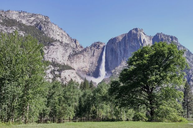
Yosemite Valley’s waterfalls are especially abundant this year due to the enormous snowpack in the southern Sierra. History was made as the Merced River’s watershed was buried under a snowpack that was 346% of normal. That wild, churning Merced River is now flowing from the high country and spreading its reach into San Joaquin Valley meadows and campgrounds.
Yosemite’s rangers are facing the challenging task of managing the big melt. Even Yosemite veterans, like Scott Gediman, are amazed by the amount of water flowing and falling into the iconic Valley. Gediman is the park’s public information officer.
Like everyone, Gediman is amazed by the historic winter California witnessed this year, “This is the biggest snowpack I’ve seen in 27 years as a park ranger here in Yosemite National Park.”
And that big snowpack is now being transformed into a big melt. Gediman says that park personnel are working hard to manage the water flows, acknowledging that it is a challenging task balancing the power of nature with visitor safety.
“With our last snow survey, we got about two and a half times of a ‘normal year’ both on the Merced River drainage and the Tuolumne River drainage here in Yosemite National Park,” notes Gediman.
“Over the past several weeks, as the flows have gone up and down, we’ve been opening and closing the campgrounds. But now that the flood watch is over, we’re still at high water, but we were able to reopen most of the sites.
“What we’re doing is just monitoring the water flow. And other factors that we look at are water across roads, for example, water on trails and things like that.”
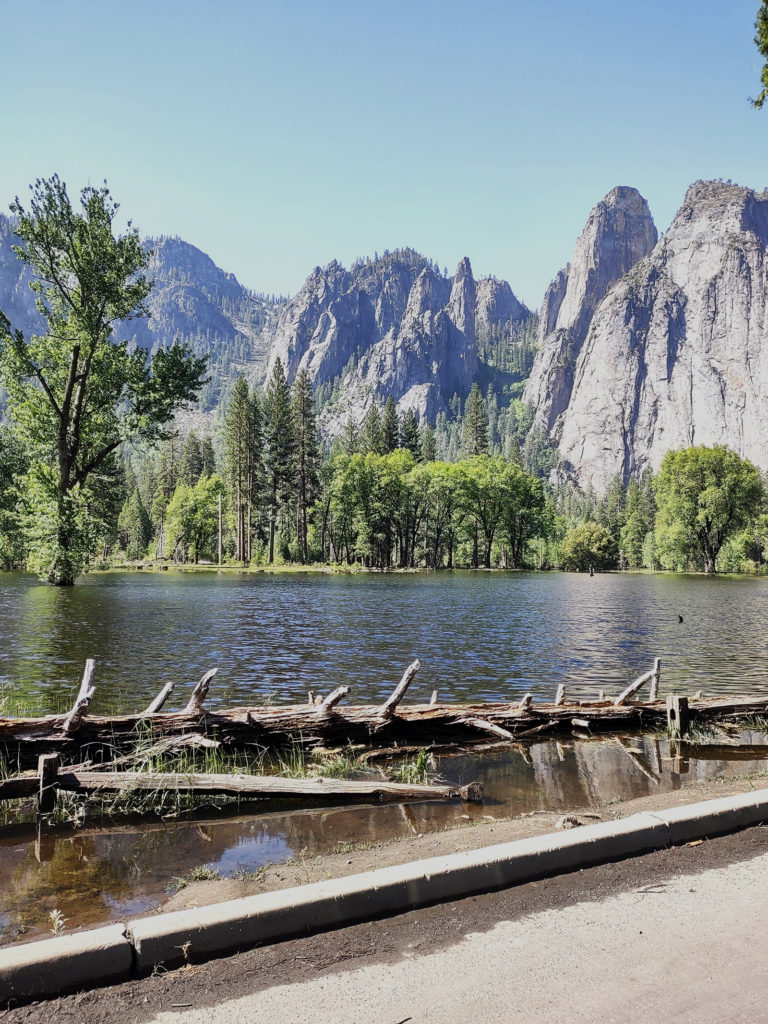
Water is truly everywhere in the Valley this year, and waterfalls are thundering. From across the valley a mile away you can hear Yosemite Falls continually booming as it plunges onto the rocks below. Expansive meadows, usually luxuriant this time of year, are submerged, having become part of the Merced River’s floodplain.
In some places, water from the distant river channel laps at the edge of the road. That’s actually a good thing because the floodwater has a beneficial impact on rejuvenating the riparian habitat and meadow vegetation.
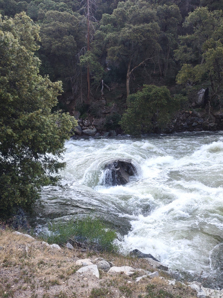
In mid-June, the Merced River was consistently at or near flood stage as measured at the Pohono Bridge at the western end of the valley. Gediman explains that keeping constant watch on the volume of snowmelt flowing into the Valley is a critical operation.
He credits the National Weather Service and the California Nevada River Forecast Center for keeping park rangers appraised with accurate information as the river level rises and falls.
“What we’ve been doing is getting daily briefings where every day they tell us what the flows are, what the projected flows are, things like that,” says Gediman.
“So, it’s those weather forecasts and flow predictions for the river that are helping us manage the park and take actions.”
Yosemite’s high country, blanketed with up to 18 feet of snow, is rapidly melting. The Tuolumne River basin received 257% of average snowfall.
Gediman reports that crews are plowing Highway 120 through Tuolumne Meadows and Tioga Pass to clear the pavement and mitigate avalanche zones. It’s especially slow and perilous work this year due to the sheer volume of snow and consequent avalanche danger.
As of this writing, the park does not have a projected date for opening Tioga or Glacier Point roads, except to say that it will be later than usual.
As the flood of summer vacationers flows into Yosemite Valley, they can expect to encounter a lot of water on the Valley floor and places like the wet and slippery Mist Trail to Nevada Falls.
Last year, a reservation system reportedly kept visitor crowding to a reasonable level. Gediman says reservations won’t be required this year.
In the meantime, Yosemite is taking another look at the visitor experience. “We have initiated a planning process called the Visitor Access Management Plan that is going to help us look at the long-term visitor access to Yosemite,” said Gediman.
“We’re just in the early phases of this planning process. We’ve had public meetings. We’re asking for the public to be engaged, and it’s really important to get robust public participation.”
With post-pandemic, social media–driven tourism burgeoning in national parks, blueprints for moderating the impacts on the country’s precious natural resources are now more important than ever.